by Misa Murohashi, translated by Bruce Rutledge,
What’s left of Seattle’s Japantown can be seen in the area around Jackson and Main streets. However, in the early 20th century, Japantown extended from the east side of Pioneer Square to the southwest part of the Central District. At its peak, it was home to
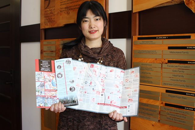
about 8,500 Nikkei, who lived and ran businesses there. In March, the Wing Luke Museum, the Japanese Cultural & Community Center of Washington and the National Park Service Klondike Gold Rush National Historical Park began distributing the Japanese American Remembrance Trail Guide, which links the old Japantown to the current International District. The guidebook was put together by a project team made up of members from those three organizations, with the support of Neighborhood Matching Fund from the Seattle Department of Neighborhoods. The illustrated map introduces 42 places of Japanese American remembrance, from currently existing places such as Maneki Restaurant or the Japanese Language School to places long gone like the Reliance Hospital, a general hospital for Japanese that operated until 1925.
“We want you to imagine the lives of the Japanese American immigrants as you walk around the neighborhood,” said Arisa Nakamura, Graphic designer/artist of this map project. “For example, after a baseball game or dinner, people would go to the public bath Hashidate Yu underneath the Panama Hotel. You can picture the scene, can’t you?” When Nakamura pursued a master’s degree in landscape architecture at the University of Washington, she studied “sense of belongings” of minority immigrants to the International District for her thesis. The ethnic groups included Japanese, Chinese, Filipino and Vietnamese. “The International District, which has housed minority groups through the past 150 years, is an important place for those ethnic groups,” she said. “ The places where those ethnic groups interacted in different eras are like layers formed on top of each other.” Nakamura says. For her thesis and this map project, she listened to many stories from Nisei about what they remember about the 42 places on the map. She hopes people looking at the guide map “will walk through the neighborhood and imagine how the Japanese immigrants of those days found happiness in a difficult environment.”
The Wing Luke Museum has added a walking tour to go along with the guide. Families, friends and school groups can make reservations for a tour. About walking tour, contact Wing Luke Museum – (206) 623-5124.


